If it forms, this system will be the first typhoon of 2025, not only in the East Sea but across the entire Northwest Pacific. However, the storm has yet to fully develop, and many variables remain - experts caution that clearer forecasts will require another 1–2 days of monitoring.
On the evening of June 9, the Hydrometeorological Agency under the Ministry of Agriculture and Environment held an online meeting to assess the tropical low-pressure system and the possibility of the first storm of the year.
The meeting was chaired by Nguyen Thuong Hien, Director of the Hydrometeorological Agency, with participation from operational forecasting centers in northern and central Vietnam, as well as experts from the Institute of Meteorology, Hydrology, and Climate Change.
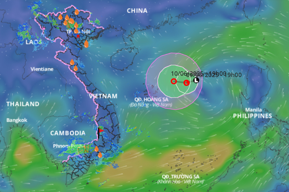
At the meeting, Mai Van Khiem, Director of the National Center for Hydro-Meteorological Forecasting, said that the tropical low-pressure system has the potential to develop into a storm. If it does, it would be the first named storm of 2025 in the region.
According to Khiem, most forecast models currently suggest that the storm could enter the area around Vietnam’s Paracel Islands (Hoang Sa) before turning north toward Guangdong Province, China.
However, other lower-probability scenarios include a westward shift toward Hainan Island, potentially moving into Vietnam’s Gulf of Tonkin.
"Since the storm hasn’t formed yet, a lot can still change," Khiem emphasized. "We’ll need to closely monitor updates over the next 1–2 days to make more accurate projections about its intensity and potential impact on sea areas or Vietnam’s mainland."
Nguyen Van Huong, head of the Weather Forecasting Division, added that the low-pressure system is currently located over waters with sea surface temperatures above 30°C and in an area with declining vertical wind shear - favorable conditions for intensification into a tropical depression.
Current international models agree that the system may strengthen into a tropical depression by the morning of June 10, and further intensify into a typhoon by early June 11, with maximum sustained winds reaching levels 9–10 (strong tropical storm).
Deputy Director of the Hydrometeorological Agency Hoang Duc Cuong warned that the storm could exhibit “complex and unpredictable” behavior, with strong intensity and a very broad wind field, necessitating vigilant tracking in the coming days.
In the immediate future, Khiem noted that the main risk over the next 24–48 hours will be strong winds affecting ships in the central and northern East Sea, with possible thunderstorms and squalls associated with the storm's outer circulation.
During the meeting, Director Hien instructed all relevant meteorological agencies to closely monitor the system, maintain regular communication with international weather agencies, and provide timely and accurate forecasts and warnings to minimize potential damage.
Bao Anh