The proposed provincial-level mergers, including 34 provinces and cities in central and southern Vietnam, aim to expand development space and prioritize the integration of mountainous and lowland provinces with coastal areas.
According to a draft resolution by the National Assembly Standing Committee on administrative unit reorganization, 52 provincial-level administrative units are expected to be merged nationwide. Among them, 34 are located in the central and southern regions.
All 19 southern provinces and cities are included in the merger proposal, while in the central region, four provinces - Thanh Hoa, Nghe An, Ha Tinh, and Hue - are excluded.
The primary goal of merging administrative units is national development. It is intended to expand the development space of newly merged units, promote the leadership role of dynamic regions, economic corridors, and growth poles.
The plan prioritizes merging mountainous or lowland provinces with coastal provinces, combining geographically adjacent units in line with development orientations to complement each other and boost regional economies. This supports Vietnam’s strategic goal of rapid and sustainable development in a new era.
Regarding the selection of new administrative-political centers, the proposed criteria favor locations with advantageous geography and synchronized socio-economic infrastructure - especially transportation (airports, roads, ports) - to ensure efficient connectivity within provinces and with national economic centers or maritime zones.
The future administrative-political centers must also offer sufficient room for development and align with economic and social growth strategies. The goal is to ensure balanced integration, minimize regional disparities, and maintain national defense and security.
Summary of geographic, socio-economic, historical, and cultural characteristics of proposed merged provinces in central and southern Vietnam:
Central Vietnam
Excluding Thanh Hoa, Nghe An, Ha Tinh, and Hue, 15 central provinces and cities are included in the proposed mergers.
North Central Coast
Quang Binh spans 7,998 km² with a population of over 900,000. It boasts 116 km of coastline and tourist hotspots like Nhat Le beach and the world’s largest cave, Son Doong. Its economy revolves around agriculture, fisheries, tourism, and mineral extraction.
Quang Tri covers 4,701 km² with a population of over 600,000. It lies along the coast and near the Vietnam–Laos border. The local economy is based on agriculture, mining, fisheries, and historical tourism - especially war relics like Quang Tri Citadel.
South Central Coast
The South Central Coast - including Da Nang, Quang Nam, Quang Ngai, Binh Dinh, Phu Yen, Khanh Hoa, Ninh Thuan, and Binh Thuan - holds strategic importance for economic development, tourism, and international trade.
The region features long coastlines, bays, and beaches such as Nha Trang (Khanh Hoa) and Mui Ne (Binh Thuan), as well as mountainous terrain that creates rich ecosystems. It is rich in natural resources, including fertile land ideal for tropical fruits, coffee, grapes, and dragon fruit.
The economy is driven by tourism and agriculture, with key crops including grapes (Ninh Thuan), dragon fruit (Binh Thuan), and coffee and pepper (Khanh Hoa). Marine industries such as fishing and seafood processing are also vital.
Despite strong growth, the region faces challenges such as climate change, labor shortages, and underdeveloped infrastructure.
Culturally, the area has deep roots in the Champa civilization, with iconic sites like Ponagar Tower (Khanh Hoa), Po Sah Inu Tower (Binh Thuan), and Cham relics in Ninh Thuan. Its position in Vietnam’s blue economy and tourism strategies continues to grow thanks to its deep-sea ports and renewable energy potential.
Central Highlands
The Central Highlands provinces - Dak Lak, Dak Nong, Gia Lai, Kon Tum, and Lam Dong - feature diverse landscapes, cultures, and resources.
Located at Vietnam’s center, the region is characterized by highlands, valleys, and tropical monsoon climate moderated by altitude - ideal for agriculture and eco-tourism.
Its economy focuses on agriculture, especially industrial crops like coffee, rubber, and pepper. It is Vietnam’s coffee capital and a key contributor to national exports. Other sectors include livestock, cassava, corn, and rice farming.
Culturally, the Central Highlands is home to ethnic minorities such as the Ede, Mnong, Jarai, and Bahnar, with distinctive traditions, including gong festivals and buffalo sacrifices.
The region’s strategic geographic location and natural wealth position it for growth in tourism, mineral extraction, and agro-processing.
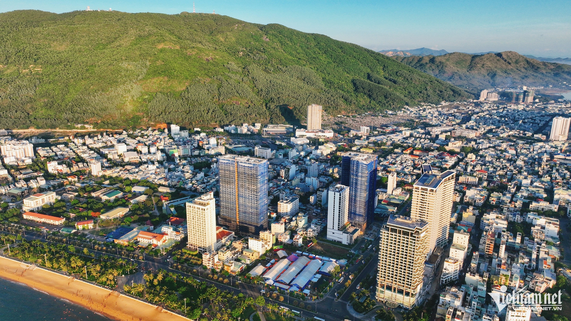
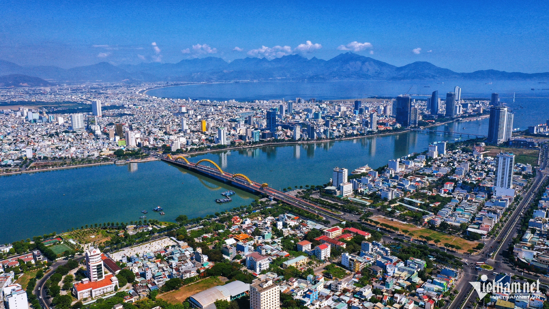
Da Nang, a centrally-run city, spans 1,284 km² with 1.2 million residents. It features a major seaport and links the North Central region with the South. Its economy thrives on tourism, manufacturing, electronics, and services. Da Nang is also a cultural hub, with landmarks such as Linh Ung Pagoda shaping the region's identity.
Southern Vietnam
All 19 southern provinces and cities are included in the proposed mergers.

Southeast Region
These include Ho Chi Minh City, Ba Ria–Vung Tau, Binh Duong, Binh Phuoc, Dong Nai, and Tay Ninh.
The Southeast borders the Central Highlands, Mekong Delta, and South Central Coast, as well as Cambodia and the East Sea, facilitating trade and development.
Ho Chi Minh City is Vietnam’s economic powerhouse, contributing significantly to national GDP. The region features high population density (778 people/km²) and a diverse cultural mix of Kinh, Hoa, Khmer, Cham, Xtiêng, and Co Ho communities.
With advanced infrastructure, modern transport networks, and a skilled workforce, the Southeast is a critical driver of Vietnam’s economy and global integration.
HCMC, Vietnam’s largest city, has a strategic port and traffic network and borders Binh Duong, Dong Nai, Long An, Tay Ninh, and the East Sea. It is a hub for industry, finance, commerce, and services, with strengths in electronics, textiles, food processing, and banking.
With a population of over 9.4 million, including large migrant communities, HCMC is a bustling metropolis with modern business zones and significant historical landmarks.
Binh Duong borders HCMC and Binh Phuoc, making it highly accessible. It has emerged as one of Vietnam’s fastest-growing provinces and top FDI destinations, thanks to its industrial parks like VSIP, Dai Dang, and My Phuoc.
The province excels in electronics, footwear, garments, and food processing and plays a vital role in national economic growth. Urban development and educational investments have attracted a diverse labor force.
Mekong Delta
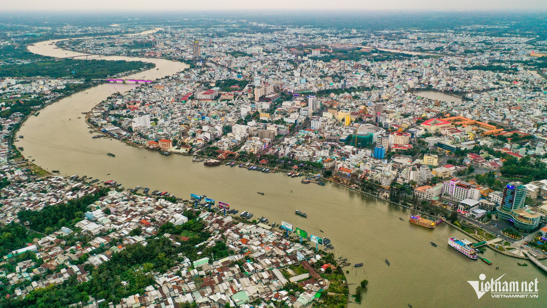
The Mekong Delta consists of 13 provinces and cities: Long An, Tien Giang, Ben Tre, Vinh Long, Tra Vinh, Hau Giang, Soc Trang, Dong Thap, An Giang, Kien Giang, Bac Lieu, Ca Mau, and Can Tho.
Formed by the Mekong River, the delta is a complex network of rivers and canals with a unique ecosystem and landscape.
Covering 40,577.6 km² and home to around 17.7 million people (2022), the region contributes over 50% of Vietnam’s rice production and 93% of rice exports. Aquaculture, especially shrimp and fish farming, is another economic pillar.
Its cultural diversity includes Kinh, Hoa, Khmer, and Cham populations, with traditional festivals such as Ok Om Bok and Chol Chnam Thmay reflecting local heritage.
Despite its vital role in food security and agriculture, the region faces challenges like climate change, land erosion, and environmental pollution. Sustainable development, environmental protection, and improving livelihoods remain top priorities.
Nguyen Thao