Vietnam has officially submitted its system of baselines in the Gulf of Tonkin to the United Nations Secretary-General, fulfilling its obligations under Article 16 of the 1982 United Nations Convention on the Law of the Sea (UNCLOS).
A UN announcement dated March 12 confirmed that, on March 7, the Vietnamese government deposited a nautical chart and a list of geographic coordinates defining straight baselines for Vietnam’s mainland territory in the Gulf of Tonkin, as well as the outer limits of its territorial sea in the region.
Vietnam’s declaration, dated February 21, 2025, detailing the baselines used to calculate the breadth of the territorial sea in the Gulf of Tonkin, will be published in the upcoming issue of the official UN publication “Law of the Sea Bulletin.”
The baselines used to determine the breadth of Vietnam’s territorial sea in the Gulf of Tonkin provide the legal foundation for defining the boundaries and extent of the country’s maritime zones, in accordance with UNCLOS and the 2000 maritime boundary delimitation agreement between Vietnam and China.
Affirming Vietnam’s sovereign maritime zones
Located in the northwestern part of the East Sea, the Gulf of Tonkin is a shared and strategic maritime area for both Vietnam and China. The Gulf spans approximately 126,250 square kilometers (36,000 nautical square miles), with a maximum width of about 320 kilometers (176 nautical miles) and a narrowest point of approximately 220 kilometers (119 nautical miles).
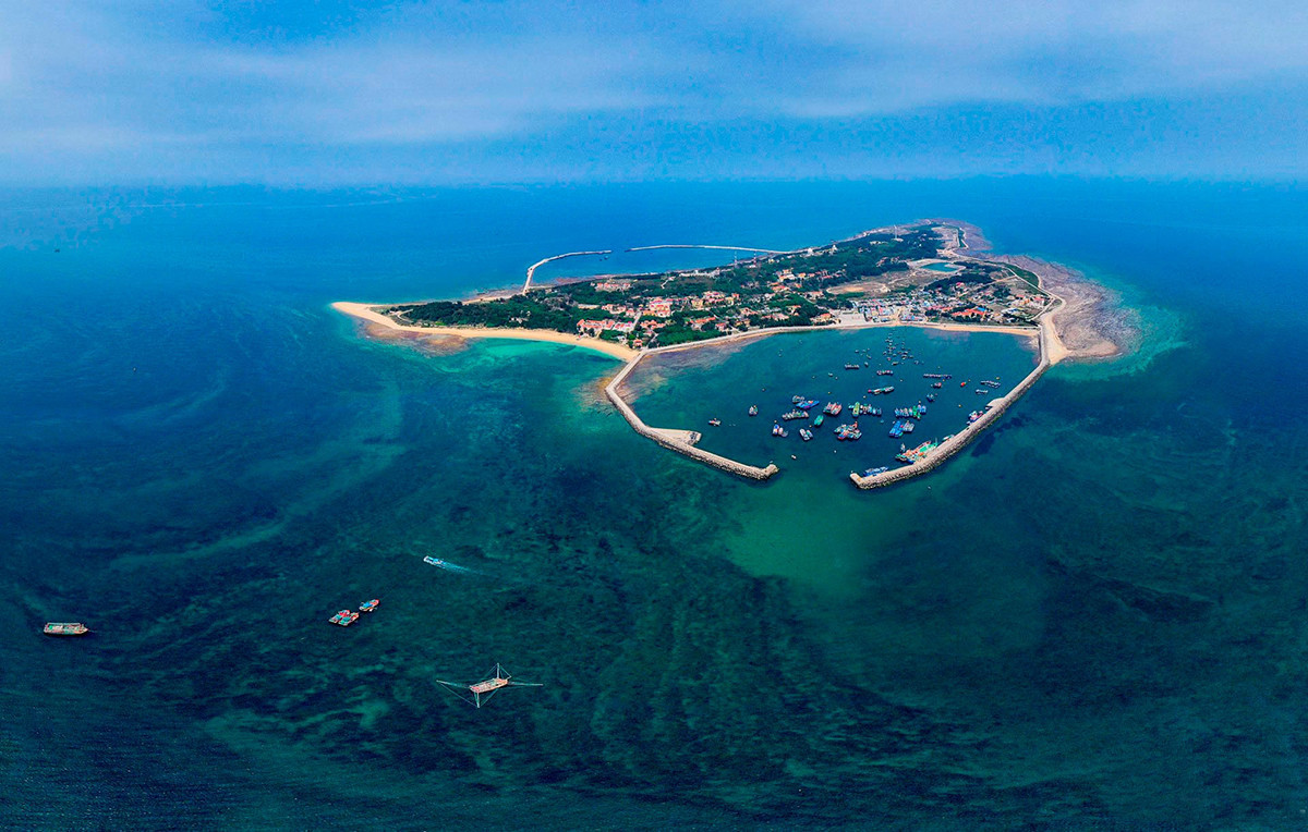
Vietnam’s coastline along the Gulf stretches 763 kilometers, while China’s extends 695 kilometers. Bach Long Vi Island, under Vietnamese sovereignty, lies around 110 kilometers from Hon Dau near the Vietnamese mainland and plays a special role in boundary delimitation.
The negotiations on delimiting the Gulf of Tonkin took place over three phases: in 1974, during 1977–1978, and again from 1993 to 2004. The final delimitation granted Bach Long Vi Island a 12-nautical-mile territorial sea and a 3-nautical-mile exclusive economic zone (EEZ) and continental shelf, equivalent to 25% effectiveness.
Vietnam received 53.23% and China 46.77% of the Gulf's area, with a ratio of 1.135 to 1. This proportion aligns with the relative lengths of their coastlines (763 km for Vietnam vs. 695 km for China) and is considered fair based on international rulings and state practices.
During the negotiations, both nations exercised restraint by not issuing unilateral baseline declarations in the Gulf. International jurisprudence and state practice suggest that unilaterally declared baselines are rarely considered in maritime boundary delimitation.
The agreement on delimitation of the territorial sea, EEZ, and continental shelf became effective simultaneously with the bilateral agreement on fishery cooperation and the establishment of a joint fishing area in the Gulf, beginning June 30, 2004.
The fisheries agreement was valid for 12 years, with automatic three-year renewals unless either party objected. In 2019, both sides agreed to extend it by one more year, concluding in 2020. Following the agreement’s expiration, both nations sought better management of the maritime zone and clearer responsibilities for maritime enforcement forces within the territorial sea, EEZ, and continental shelf. There was also a need to monitor the right of innocent passage in territorial waters and to uphold other freedoms of the sea in their respective EEZs.
The baseline declaration also relates to national airspace boundaries, which are defined vertically above the 12-nautical-mile territorial sea limits. This clarity helps improve the management of international air routes entering the national airspace of both countries, enhancing aviation security and international trade.
The baseline declarations by both countries in the Gulf of Tonkin will not affect the agreed maritime boundaries, as all treaties and agreements on border and maritime delimitation have permanent legal force and cannot be altered by changing circumstances (as stated in Article 62 of the 1969 Vienna Convention on the Law of Treaties, to which both Vietnam and China are parties).
China has affirmed that its March 1, 2024, baseline declaration complies fully with its domestic laws, international law, and bilateral agreements, and does not infringe on Vietnam’s rights or those of any other country.
Vietnam’s February 21, 2025, declaration reiterated the points of the maritime boundary between the two countries at the mouth of the Bac Luan River. It included nine coordinates based on the delimitation agreement of the territorial sea, EEZ, and continental shelf, linking to Point 10 located in Vietnamese waters. This declaration serves as a reference for law enforcement forces and maritime vessels.
Therefore, Vietnam’s baseline declaration in the Gulf of Tonkin on February 21, 2025, was not a response to China’s March 1, 2024, declaration. Rather, it reflects Vietnam’s objective need for marine management and international cooperation. It asserts Vietnam’s rights and obligations under the 1982 UNCLOS and aligns with the 2012 Vietnamese Law of the Sea.
This legal foundation is crucial for protecting and exercising Vietnam’s sovereignty, sovereign rights, and jurisdiction, while contributing to economic development, maritime governance, and international collaboration.
Conforms to the provisions of the 1982 Law of the Sea Convention
The declaration of baselines for calculating the breadth of the territorial sea falls within the sovereign rights of coastal states. UNCLOS allows unilateral declarations of baselines, provided they comply with international law, especially Articles 5 (normal baselines) and 7 (straight baselines). Coastal states may adopt normal, straight, or a combination of baseline methods.
UNCLOS does not explicitly define a chain of islands, the distance between them and the coast, or the length of baseline segments. However, any claim must demonstrate that the waters enclosed by the baselines are historically and functionally integral to the national territory to qualify as internal waters.
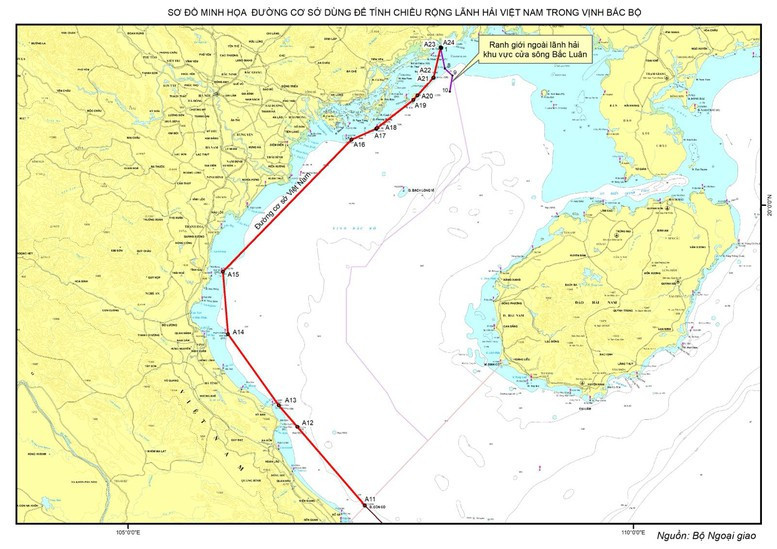
Vietnam’s baselines in the Gulf of Tonkin are based on a mixed method, using both straight and normal baselines for Bach Long Vi Island. The February 21, 2025, declaration fully complies with UNCLOS and does not conflict with Article 8 of Vietnam’s 2012 Law of the Sea: “The baseline used to calculate the breadth of Vietnam’s territorial sea is the straight baseline declared by the Government. The Government shall determine and declare baselines in areas where none have been previously defined, following approval by the National Assembly’s Standing Committee.” The use of both baseline types reflects Vietnam’s flexible approach.
Vietnam’s straight baseline in the Gulf of Tonkin connects a chain of islands aligned with the general coastal configuration. This line links 12 islands, with the farthest point being Thanh Lam Island, 21.59 nautical miles from shore. Other islands lie within 12 nautical miles of the mainland. These islands are close to the shore, aligned with the coastal trend, and do not exceed the territorial sea’s breadth.
Importantly, Vietnam’s straight baseline in the Gulf of Tonkin does not intersect any international straits or areas with international navigation routes. It therefore does not impede the right of innocent passage through territorial waters or the freedom of navigation in the EEZ.
In conclusion, Vietnam’s baseline declaration in the Gulf of Tonkin has a solid legal foundation and is consistent with the 1982 UNCLOS.
Nguyen Hong Thao