Meteorologists have revealed the cause behind the intense thunderstorms that struck northern Vietnam and the Gulf of Tonkin on the afternoon of July 19, triggering widespread rain, powerful winds, and a capsized tourist boat in Ha Long Bay.

Rescue efforts underway after a tourist boat capsized in Ha Long Bay due to strong winds. Photo: Pham Cong
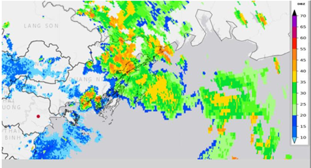
On the evening of July 19, the National Center for Hydro-Meteorological Forecasting (NCHMF) reported widespread thunderstorms over northern Vietnam and the Gulf of Tonkin, including strong gusts, whirlwinds, and localized heavy rain. Notable wind speeds recorded included 16m/s (level 7) at Cua Ong (Quang Ninh), 26m/s (level 10) at Bai Chay, and 18m/s (level 8) at Bach Long Vi (Hai Phong).
At the time, tropical storm Wipha (storm No. 3) remained over 1,000km east of Ha Long Bay. Although its wind field extended 200-300km from the center, the storm had not yet made a direct impact on the Gulf.
Meteorologists explained the cause of the violent weather as a result of a tropical convergence zone positioned over northern Vietnam, combined with persistently high surface temperatures over the previous three days. These conditions triggered strong convective updrafts in an unstable atmosphere, producing a mesoscale convective system (MCS) - a large, organized storm complex typical of tropical regions. Such systems can span several hundred kilometers and persist for up to 24 hours, producing intense rainfall and hazardous weather phenomena.
According to the Quang Ninh Provincial Disaster Management Board, the tourist boat QN7105 capsized in a storm while navigating Tour Route 2 of Ha Long Bay, between Hon Ga Choi and Bai Tho Mountain, about 3 nautical miles offshore. The boat was carrying 48 passengers and 5 crew. Emergency teams rescued many of the occupants, though several remain missing.
Forecasting and warning efforts
The Hydro-Meteorological Agency affirmed that all monitoring and communication systems had been operating effectively to support forecasting and disaster response.
In its 4:30 AM bulletin on July 19, the NCHMF forecast rain and scattered thunderstorms in the Gulf of Tonkin, with potential for whirlwinds and strong gusts. Quang Ninh’s meteorological station followed protocol, issuing alerts at 11:45 AM and again at 1:30 PM, warning of thunderstorms, lightning, hail, and heavy rain in the Ha Long area.
Additionally, a marine forecast bulletin issued at 3:30 PM on July 18 had already projected rain and stormy seas in Bai Chay and surrounding waters on July 19.
Due to storm Wipha’s approach, rain and thunderstorms are expected to persist across the Gulf of Tonkin and East Sea from the night of July 19 through July 21. Wind speeds near the storm’s center could reach level 12 (89-117km/h), gusting to level 15, with waves as high as 6 meters.
From July 21 to 23, northern and north-central Vietnam may experience a large-scale rain event, with average rainfall between 100-200mm and localized areas exceeding 300mm. The northeast, Red River Delta, Thanh Hoa, and Nghe An provinces could see rainfall of 200-350mm, with isolated pockets reaching over 600mm.
The NCHMF continues to closely monitor the storm and will issue timely updates to assist government response and public safety efforts.
Bao Anh